

Thousands of archaeological sites have been quietly sitting beneath the farm fields of Bohemia in the Czech Republic, completely out of sight. Among them are dozens of Neolithic burial mounds estimated to be around 5,000 years old. Researchers already had reason to believe they were there, but pinpointing them was another matter entirely — until a new study published in Archaeological Prospection changed that.
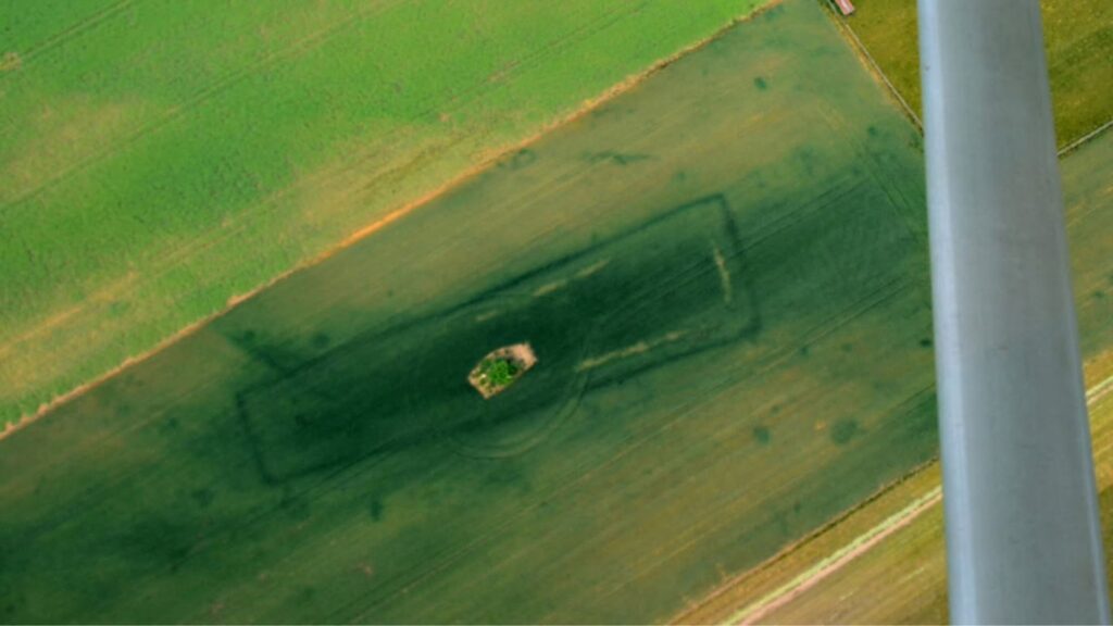
The structures in question are known as long barrows, elongated burial mounds that were common around 3000 B.C.E. and represent some of the earliest monumental tombs ever built in Central Europe. Despite being widely documented in historical records, their exact locations across the Bohemian landscape had remained out of reach — hidden beneath centuries of agricultural activity and changed terrain.
The research was led by Czech scientists from the Institute of Archaeology at the University of Wroclaw, working alongside teams from the universities of Pilsen, Hradec Kralove, and Prague. Rather than relying on a single method, they combined multiple remote sensing technologies to get a clearer picture of what was buried beneath the surface, producing results that offered a completely fresh view of the Neolithic landscape beneath.
The Technology Behind the Discovery
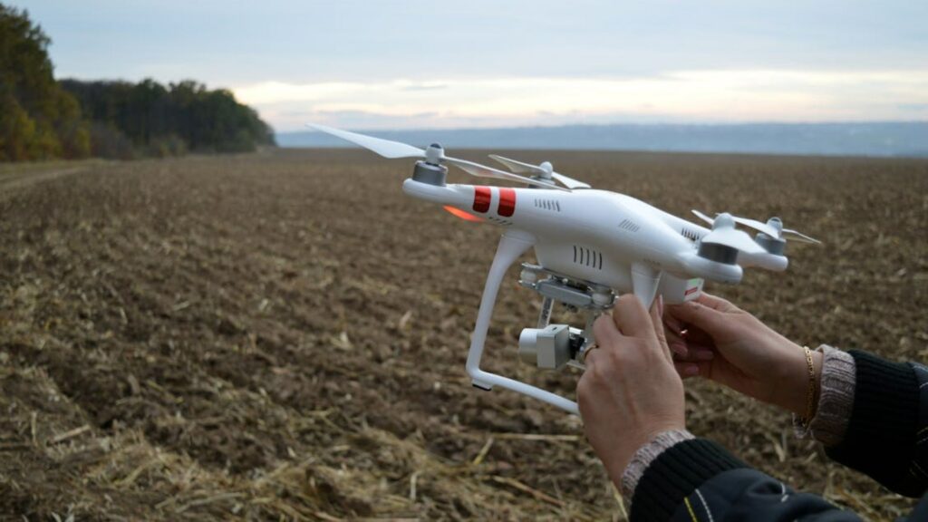
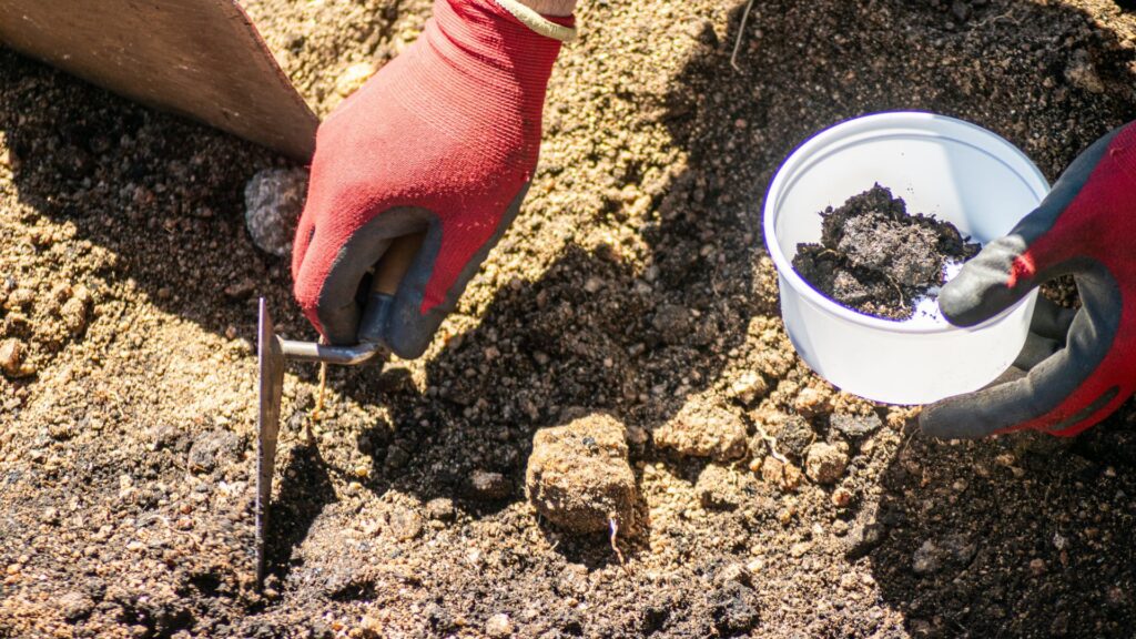
Three distinct tools made the discovery possible, working in combination. Aerial survey captured patterns in crop growth that hint at what lies beneath. Airborne laser scanning detected elevation changes as subtle as a few centimeters across the terrain. Ground-based magnetometry mapped variations in soil magnetism. Together, according to the study, they revealed a detailed picture of Neolithic settlement even across land that had been under cultivation for centuries.
Aerial photography, particularly oblique photographs taken at an angle, proved especially valuable for identifying the characteristic outlines of long barrows. The magnetic surveys went a step further, offering a look at internal structure and construction details, including burial pits that would otherwise remain obscured beneath the surface. The combination gave researchers a layered view of the sites that no single method could have provided alone.
In total, the team identified approximately 2,900 archaeological features across the study area, grouped into four major clusters, according to the study. Along with the long barrows, researchers also located circular monuments and additional burial-related structures at the sites. Each finding added detail to a picture of how Neolithic communities in Bohemia organized their funerary practices and built meaning into the terrain around them.
What the Burial Mounds Reveal About Prehistoric Communities
The burial mounds did not end up where they did by chance. Evidence from the study showed that long barrows were deliberately built at the edges of settled areas, positioned as far as 1,500 feet from the communities they were associated with, according to Popular Mechanics. That deliberate distance created a clear physical boundary between where people lived and where the dead were laid to rest.
Archaeologists had long theorized that this kind of spatial separation existed in Neolithic societies, but solid evidence had been difficult to establish. The remote sensing data confirmed it directly for the first time. The findings suggest these communities maintained a structured and intentional approach to death, placing their burial monuments in a distinct zone just outside the boundaries of everyday life.
The sites also show signs of repeated use over long periods. Evidence indicates that prehistoric communities regularly returned to these locations across many centuries, treating them as fixed points of ritual significance. The authors noted that Neolithic long barrows functioned as enduring gathering points for ceremony rather than one-time burial sites abandoned after use.
A Hidden Landscape Slowly Coming Into View
One of the broader takeaways is that intensive agriculture had not erased everything, as significant traces of Neolithic burial monuments and their surrounding terrain still survived beneath the fields, waiting for the right combination of technologies to bring them back into view after thousands of years.
The research team stressed that no single method was responsible for the results. It was the systematic use of complementary remote sensing techniques working together that made detection and interpretation possible. That approach, the authors noted, made it possible to reconstruct prehistoric land-use strategies and social practices in ways that were not achievable before these tools were available.
The study ultimately points to a landscape that was far more organized and intentional than its current agricultural appearance would suggest. Bohemia’s farm fields have been quietly preserving a structured Neolithic world just beneath the surface, one where the division between the living and the dead was not just a cultural idea but a deliberate feature of the land itself.